History
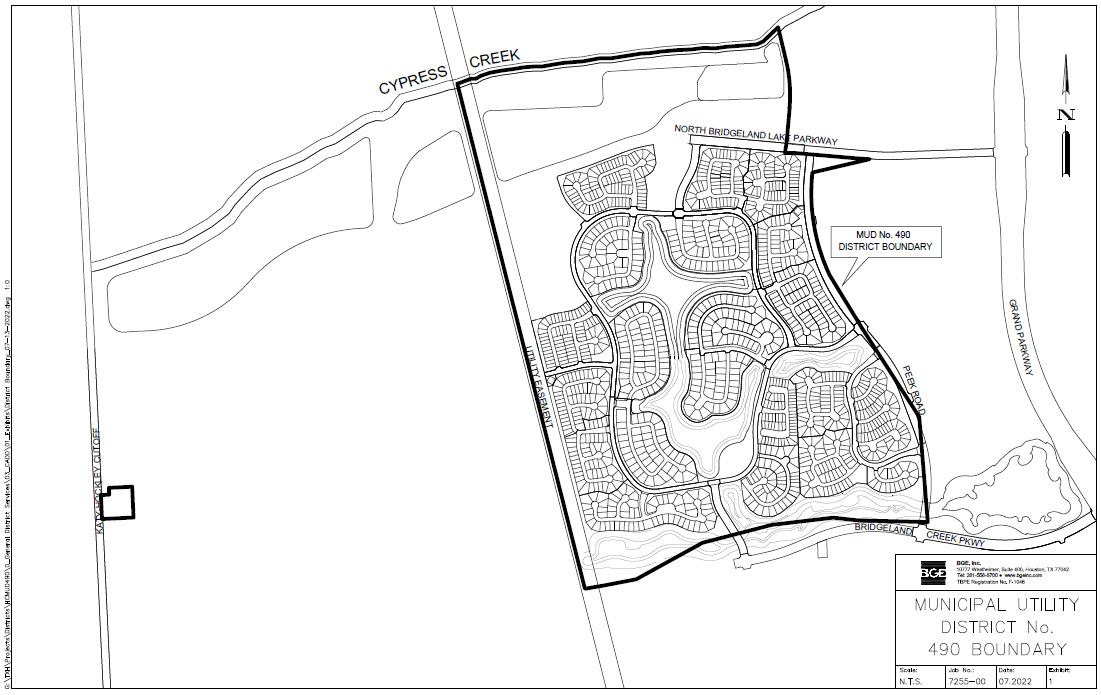
The district is a political subdivision of the state of Texas, created by an order of the Texas Commission on Environmental Quality (the “TCEQ”) on July 12, 2007, and operates pursuant to Chapters 49 and 54 of the Texas Water Code as amended. The District includes approximately 674 acres of land within its boundaries.
The District is located approximately 25 miles northwest of the central downtown business district of the City of Houston, Texas and lies wholly within the exclusive extraterritorial jurisdiction of the City of Houston and within the boundaries of the Cypress – Fairbanks Independent School District and Waller Independent School District. The District is located approximately seven (7) miles south of the intersection of U.S. Highway 290 and U.S. Highway 99 (the Grand Parkway) and is bordered on the north by Cypress Creek, on the east by the Grand Parkway right-of-way, on the west by Katy-Hockley Road and on the south by Bridgeland Creek Parkway. Access to the District is provided by Grand Parkway south to Bridgeland Creek Parkway or by the Grand Parkway north to Bridgeland Creek Parkway.
District Map